
The Bourget Lake, the largest natural lake in France, attracts visitors to its developed beaches and water sports centers each season. However, the less frequented coves on its west bank are difficult to compare objectively: accessibility, regulations, types of permitted vessels, and levels of tranquility vary from site to site. What criteria allow us to distinguish a truly preserved cove from a simple outlying beach?
2026 Regulations on Bourget Lake: What Changes for the Coves
The new navigation rules that came into effect in 2026 directly modify the experience in the inlets and small bays. The Grand Lac agglomeration has imposed a minimum distance of 200 meters between motorized boats and swimming areas, reserving this space for gentle activities: swimming, paddleboarding, kayaking.
This measure creates pockets of calm around the coves accessible by swimming or light craft. Anchoring remains prohibited in protected areas (seagrass beds, reed beds), which also reduces motorized traffic near sensitive natural zones.
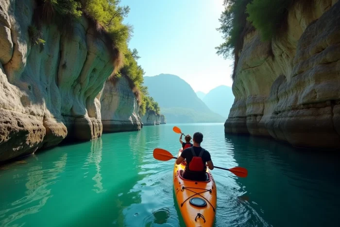
For those wishing to explore the coves of Bourget Lake by kayak or paddleboard, these restrictions represent a tangible advantage: less noise, fewer waves, and privileged access to corners that motorboats can no longer approach.
Coves on the West Bank of Bourget Lake: Access and Activity Comparison
Not all coves are equal. Some are reachable on foot from a marked trail, while others can only be accessed by water. The type of vessel also conditions the experience: a rigid kayak allows for hugging the cliffs, while an inflatable paddleboard is easier to transport but handles choppy water less well.
| Criterion | Coves Accessible on Foot | Coves Accessible Only by Water |
|---|---|---|
| Physical Effort | Hiking for several tens of minutes, sometimes on a steep trail | Paddling from a public launch site |
| Required Equipment | Hiking shoes, swimsuit | Kayak or paddleboard, life jacket |
| Visitor Traffic | Variable depending on the season and signage | Generally low |
| 2026 Regulations | Protected swimming area if marked | Anchoring prohibited near seagrass beds, motors at a distance |
| Level of Tranquility | Medium (accessible to hikers) | High (natural filtering by effort) |
The table highlights a simple pattern: the more effort required for access, the calmer the cove remains. Coves accessible only by water combine two filters, the distance of paddling and the necessary equipment, which naturally limits visitor traffic.
West Bank vs. East Bank: Two Different Logics
The east bank, near Aix-les-Bains, concentrates developed beaches, water sports centers, and tourist infrastructure. In contrast, the west bank, backed by the foothills of the Épine massif, features a more rugged terrain and almost absent urbanization in some areas.
This geography produces the most isolated coves. The limestone cliffs plunge into the water and create natural recesses, sometimes barely visible from the open water. The geology of the west bank is the primary factor for preservation, well before any regulations.
Gentle Activities in Savoie: Kayaking, Paddleboarding, and Swimming in Calm Waters
The 2026 regulations reinforce a trend already visible: the development of routes for light craft on Bourget Lake. Several local providers now offer guided tours along the west coast, with stops at lesser-known coves.
The choice of vessel depends on the objective:
- Sea or lake kayaks offer stability and storage capacity for several hours of outings along the cliffs, with the possibility to navigate narrow passages
- Inflatable paddleboards can be carried in a backpack, allowing for a combination of land hiking and launching from a remote point
- Open water swimming, whether guided or solo, provides access to micro-coves where even a kayak cannot pass, provided one can manage the distance and water temperature
The waters of Bourget Lake remain cool until June, even in warm years. A short wetsuit is recommended for early morning outings in spring.

Biodiversity and Protected Areas: Why Some Coves Remain Inaccessible
The anchoring prohibition in seagrass and reed areas is not trivial. These zones, spread along the west bank, harbor underwater vegetation that plays a direct role in water quality and the reproduction of several fish species.
Approaching these areas in light craft is possible, but stopping there is not. This nuance is central for kayakers or paddleboarders who spot an attractive cove: if seagrass is visible beneath the surface, landing or anchoring exposes one to a fine.
This constraint also explains why some inlets retain their wild character. The anchoring prohibition keeps pleasure boats away, and the absence of a land trail filters hikers. The result is access effectively reserved for experienced swimmers or paddlers who do not stop.
Identifying Sensitive Areas Before Departing
The Savoie prefecture publishes maps of regulated navigation zones. Before any outing to the west bank, checking the areas prohibited for anchoring avoids an unpleasant surprise. Local kayak providers generally incorporate this information into their departure briefings.
The most preserved coves of Bourget Lake are so due to a combination of geography, regulations, and physical effort. The 200-meter distance imposed on motorized boats in 2026, the anchoring prohibition on seagrass beds, and the steep terrain of the west bank create a triple filter that only gentle practices can cross. This natural and regulatory selection maintains their secret character.